
Alpine Lakes Wilderness Guide
Book Review:
Add This To Your Collection?
By Diane Spicer

This Alpine Lakes Wilderness Guide book review by Hiking For Her gives you the details on a new (June 2019) trail guide to 400,000+ acres of mind blowingly gorgeous hiking destinations in Washington State, USA.
Alpine Lakes Wilderness: The Complete Hiking Guide
written by Nathan Barnes and Jeremy Barnes
Hiking For Her received a complimentary copy of the book from Mountaineers Books in exchange for an unpaid review.
There is no affiliate relationship between the book publisher and Hiking For Her.
Disclosure: I've hiked almost all of these trails over the past 30 years, so I feel uniquely qualified to comment on this book.
Alpine Lakes Wilderness Guide
book review
This review is written for hikers who yearn to sample Western Washington's breathtaking high alpine, densely wooded terrain, and everything in between, but don't know where to start.
It's also written for Pacific Northwest natives who seek trustworthy guidance on how to fully tap out the area bounded roughly by U.S. 2 to the north, Interstate 90 to the south, and Hwy 97 to the east - one hike at a time.
And here's a third category of hikers who will benefit from this review: beginner hikers located anywhere in the world, looking to plan day hikes or backpacking trips to premier hiking destinations in the upper left corner of the United States.
Regardless of why you're reading this review, let's take a close look at the promise of a "complete" hiking guide to the Alpine Lakes Wilderness.
What to expect
when you pick up this book
The size and contents of this guide:
- 6 3/4 inch x 9 inch paperback
- 320 pages
- 100 trail descriptions, day hikes and backpacking
- 125 color photos
- 101 maps
- $24.95 at time of release (June 2019)
It's a hefty book, not meant to be thrown into your backpack. Think of it as a hiking trail encyclopedia for the Alpine Lakes Wilderness.
Alpine Lakes Wilderness Guide
book review:
useful features
Hiking gear should be designed with useful features to help you achieve your objectives.
I include hiking guide books on my gear list as essential tools in the planning phase for a season of day hikes and multi day backpacking trips.
Some guides are more useful than others in this regard.
Here's what I look for in a good hiking guide book:
- It orients you quickly, using a logical structure.
- It offers you detailed information (written and visual) to select a suitable hike for your interests and ability level.
- It provides additional resources to make that hike happen.
This guide book is solid on all three criteria.
Let's see why.
Don't skip the
"How to use" section
If you've never used a guide book like this one to plan a hike, you might make the mistake of paging through it, looking at photos of tempting scenery.
- No judgment, I promise. The color photos are waiting for you to enjoy.
However, I recommend a different approach.
First thing, turn to the explanation of how the authors set up the guide book.
- If you understand their logic and labels, it will save you some aggravation when you begin to get serious about trail selection.
In this guide, I'm happy to report the format used to write each trail description is right up front (pages 21 - 26).
For every hike you're considering, you'll learn:
- distance
- elevation gain
- high point
- difficulty (see discussion below)
- hiking time
- best season to hike
- volume of trail traffic
- permits required
- maps needed
- trailhead GPS coordinates
- notes
I've never seen a guide book with a "recommended snacks" section, but I graciously offer to collaborate on the next edition ;)
As you can see, there's a lot that goes into choosing a suitable hiking destination (and writing a guide book).
Pull out a pack of sticky notes and use this tip:
Read through the list again to select the main criteria you're going to use to pick a hike:
the season, the distance, what you find at trail's end, how busy the trail is, whatever matters most to you as a hiker.
Start marking hikes with those stickies!
Another useful feature:
the "Hike Finder" table
The Hike Finder section, located right after the Table of Contents, is a distillation of the guide book's information.
Don't be overwhelmed by this organized summary of facts.
Instead, use it to study up on interesting-to-you hikes in three categories:
- Easy (14 hikes)
- Moderate (44 hikes)
- Hard (47 hikes)
Once you choose a difficulty category, you can drill down using the other criteria you've marked with your stickies (see above).
Caution:
hiking styles do vary
Here's the disclaimer I would attach to the Hike Finder:
- "Easy", "moderate" and "hard" are subjective terms, uniquely defined by each of us as a hiker.
The authors are young men with deep familiarity with these trails (no learning curve).
I'm an experienced older female hiker with the inevitable "gifts" of aging knees (slower hiking pace).
And you are who you are as a hiker.
But all of us can count on one thing using this guide book:
- Hikers must gain, and then lose, a lot of elevation in order to get to the good stuff in the Alpine Lakes Wilderness.
And by good stuff, I mean sweeping vistas, heart stopping views of neighboring snow capped peaks, thundering waterfalls, serene alpine lakes - all well worth the sweat and toil.
What makes it a hard hike?
Ah! you're looking for a definition of a hard hike in the Alpine Lakes Wilderness.
I've put the key words in bold in the authors' definition of "difficulty".
- "Beyond elevation gain, other factors rolled into the difficulty rating include the quality of the trail, the difficulty of navigating obstacles, and the extent to which the trail is maintained."
Just for fun, a comparison
To see if I agreed with their difficulty ratings, I picked out three hikes I know well and would label as "hard", using the Hiking For Her "do my knees like this hike?" scale.
This subjective scale was developed over five decades of hiking on U.S. and western Canadian trails (which means gaining, and dumping, huge amounts of elevation every day).
- When my knees scream NO, it's a hard hike.
- When I don't hear from them, it's easy.
The three hikes I chose pass through a variety of terrain and as you can see, the distance and elevation gain varies as well:
- Tuck & Robin Lakes (12 miles, 2900 feet gain)
- Marten Lake (8.4 miles, 1800 feet gain)
- Snoqualmie Mountain (3 miles, 3100 feet)
Next, I read the descriptions of each hike and compared it to my own experience with the trail.
The results of my comparison?
I agree with the authors about why these particular hikes are hard for both young male hikers and older females.
So go ahead and trust the rating scales in this book.
- Use them as a starting point for sorting and sifting your way through the hikes in this book.
- And be pleasantly surprised if a "hard" hike isn't all that bad on a "good knees" kind of day.
Another useful feature:
the guidebook maps
Maps are important when you're sizing up a trail, and become really important when you're actually on the trail.
But you'll need different kinds of maps for planning and navigation.
Let me explain.
A guide book should give you an overview map of the area contained in its pages. This is useful for finding trailheads near you or concentrated in a particular locale.
This book offers a nice overview map on pages 12 and 13.
- Each hike is assigned a number on the map, corresponding to its trail description.
You also want to see a more detailed (high level topographical) map attached to each hike description.
The trail head and parking area, route and destination should be clearly labeled.
Also look for this information:
- Labeled surface water features (creeks, rivers and lakes): important trail crossings, water sources and recreation spots
- Names of prominent features: peaks, valleys, drainages and ridges along the trail
- Distances between features, and total trip distance: sets your hiking pace and mental expectations
This guide did an adequate job of providing this information.
What about maps for navigation?
As noted, each trail description in this guide has a well labeled map to provide a visual description of the topography of the hike on a superficial level.
But you will need to find, carry, and use detailed topographic maps (old school paper or electronic) on your hike.
This book supplies the information you need to quickly and accurately locate the pertinent maps for your chosen hike.
Example:
For Hike #33, the Commonwealth Basin to Red Pass Trail, bring at least one of these maps:
- USGS Snoqualmie Pass map
- Green Trails Snoqualmie Pass No. 207 map
FYI:
USGS = United States Geological Survey; check out their extensive map selection here.
Alpine Lakes Wilderness Guide
book review:
what I liked most
It was fun to see which photos were chosen to illustrate each trail.
I've got a zillion photos of my own after hiking theses trails over the decades.
Did they choose the iconic photo of each place that marks it in my personal memory?
I was surprised several times to see a new or different aspect to a trail I've been on several times.
And if you've never visited this corner of the United States, the photos are going to make you drool.
So much gorgeous rock, water, and terrain to explore!
- Don't fight the urge to grab your boots and make a beeline out there ASAP after you get this book.
Hiking with Nathan and Jeremy
The old saying "hike your own hike" points to the fact that your hike description and mine won't match up exactly at the end of the day.
That's why I turned right away to the authors' comments.
It's clear how much they understand and appreciate these trails. They provide lots of information that will help you choose a satisfying hike.
Extras for your enjoyment
The juiciest part of each trail description was found in the "going farther" and "history" paragraphs.
If you're willing to add a few more miles to your hike, your chances of scoring some quality alone time increase exponentially on some of these trails.
- Be sure to read the recommendations for extending your hike to gain some solitude.
While you might hit the trail for physical exercise and fresh air, you can also trace a lot of Washington State history by putting boots to these trails.
- Bonus: there is a Guide To Place Names at the back of the book for an extra dose of history.
A few heads up
If you've never used a trail guide like this before, let me offer a few words of caution.
Expect the unexpected
Writing a trail guide can be an exercise in futility.
As soon as the words hit the page, trail conditions can will change.
So don't expect that everything you read in this guide book will be 100% accurate at the time you show up at the trail head.
Trail conditions change every week, depending upon wind storms, flooding events that wipe out roads and bridges, fires and other factors.
Let me give you a "human factor" example.
I happened to be on the Foss Lakes Trail (#66, page 203) last week.
The trail description in this guide promises the availability of a privy at the trailhead.
However, the door was locked.
As luck would have it, I met a ranger on the trail and asked about the locked door.
- She explained that recent government furloughs had pushed back their schedules, and that many trailheads haven't officially opened yet for the summer season.
So as always as a hiker, be prepared for the unexpected!
Run everything through
your own filter as a hiker
Every time you hit the trail, your body will have different things to say to you.
Some days, your legs will feel like they can go on forever, but your breathing might be a bit ragged.
On other hikes, your thigh muscles will feel like cement while your annoyingly helpful brain is urging you on to score that waterfall selfie.
So use this guidebook to decide on a primary destination, along with a few nearby hikes you can drive to in order to save your hiking dignity.
Just kidding!
There's no shame in dialing the difficulty level down a notch on any given day, and that Hike Finder section will help you make contingency plans before you even leave home.
Truth be told, I've also bailed on a hike if the biting black flies were overwhelming: why suffer through the forest when there's a ridge hike with bug free breezes nearby?
I've also switched trails when the weather didn't match the forecast, swapping an exposed route for a more sheltered hike.
So there are many reasons why it's a smart idea to have a short list of suitable hikes in the same area.
- This guide book is organized in a way to help you generate those Plan B lists.
Alpine Lakes Wilderness Guide
book review conclusions
It's a fact of life that a hiker can never have too many trail guides.
- The size of your bookcase is your only limitation, unless piles of books on the floor double as end tables in your home. (Just me?)
After spending some time with this book, I'm ready to give up my dogeared, scrawl covered copies of guide books to this hiking region, some of them copyrighted in the early 1970s.
Here's another thing: I trust these authors.
They're the real deal.
They've been hiking (and reporting on trails) in this area for many seasons, and clearly have your well being and enjoyment of the trail in mind.
It's wonderful to see their hard earned trail wisdom pulled together in this updated and easy to use guide to the Alpine Lakes Wilderness hiking smorgasbord.
Let's send them a virtual high five. Well done, guys!
Details on purchasing a copy are found here.
 Cover provided by Mountaineers Books
Home page > Best Hiking Gear And Book Reviews >
Alpine Lakes Wilderness Guide Book Review
You might like to read these next!
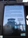
Hiking Washingtons Fire Lookouts Book Review
Want to shake up your hiking routine? Read Hiking For Her's Hiking Washingtons Fire Lookouts book review for fresh destinations for your next day hike. Combine history, panoramic views, and muscle power.
Fall Color Hikes Washington Book Review From Hiking For Her
If you're hungry for some autumn colorful hiking, use this Fall Color Hikes Washington book review to pick some fantastic hikes.
Trees of the West Book Review
Look at nature through an artist's eyes in this Trees of the West book review by Hiking For Her.
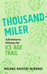
Thousand-Miler Book Review: Adventures Hiking The Ice Age Trail
This Thousand-Miler book review is aimed squarely at you if the Ice Age Trail is whispering to your hiking boots. Follow one woman on a quest to hike a thousand miles in 5 weeks.


|
I get emails all the time about what I wear, eat, carry and love to use on the trail. That's
why I provide affiliate links to you: the best gear that I use myself and have seen used by other hikers is instantly
available for your consideration, and the gear company sends a few
pennies per dollar to this reader-supported hiking website. There is no added cost to you! Everyone ends up a winner: Great gear for you, strong gear companies, and more free hiking tips for everyone. Thanks very much for your support. It's warmly and sincerely appreciated. It also helps send these hiking tips to all your virtual trail buddies around the globe. |
 |
|
Diane Spicer was a beginner hiker in 1971, and never stopped hiking. She founded the Hiking For Her community in 2008 to encourage female hikers, those who wanted to begin hiking as well as those who were in love with this fantastic sport already. On this website she shares expert hiking tips and recommendations, gear reviews and photos from her outdoor adventures so you can learn the necessary skills for comfort confidence and safety on a hike. This reader supported website does not use sponsored or promoted content. There are no ads, no AI content or artificially generated or touched up photos, no paid link placements. Everything you read is based on decades of personal hiking experience in many different locations. Please enjoy these expert hiking tips as you explore what hiking offers in any weather, season or location. |
 |
Scraping the contents of the Hikingforher.com website for the purpose of AI (artificial intelligence) LLM (Large Language Model) training is strictly forbidden.
All rights reserved. No duplication of content without permission.
Photo credits: All photos on this website were taken by David Midkiff or Diane Spicer except where noted.
Disclosures
Privacy Policy
Copyright
Media
Hiking For Her is a participant in the Amazon Services LLC Associates Program, an affiliate advertising program designed to provide a means for us to earn fees by linking to Amazon.com and affiliated sites.