Northwest Territories backcountry trip report:
14 days of river rafting and hiking
By Diane Spicer
You've landed here because you're curious about my Northwest Territories backcountry trip report. Welcome!
And maybe you're wondering where the heck NWT is.
First of all, think north, way far north.
Not quite as far as Santa Claus and Rudolph, but close.
That's where I went in July 2025 for 14 days of backcountry bliss, navigating wild untamed rivers and untouched landscapes day after day in the endless Arctic light.
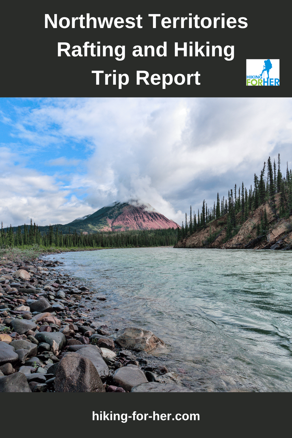
Hopefully the photos taken by my husband David Midkiff will give you an enticing glimpse of this pristine, rugged and remote area of North America.
I'll weave in some of my best hiking tips and tricks, along with the gear I used on this trip, just to keep things interesting.
If you have questions for me on gear or logistics after reading this Northwest Territories backcountry trip report, use my contact page.
Northwest Territories backcountry trip report:
Let's locate where & when we started
Start with this map. It brings you to the general (and vast) area.
Locate Normal Wells on it.
That's where this Northwest Territories backcountry trip report begins.
Commercial airliners are able to land in Normal Wells, via Yellowknife NWT which receives flights from Vancouver, Calgary and other major Canadian hubs.
It's a long haul from the United States.
To get oriented, use a few well known landmarks.
- See how (relatively) close Norman Wells is to the Beaufort Sea?
- Great Bear Lake, even closer!
Pretty far north, eh? (as they say in Canada)
But now the real fun begins. (Not that crossing an international border and changing planes three times with a duffel full of gear wasn't fun.)
Thundercloud Lake is our next destination. This map will give you an overview of the location, or you can click through for a large interactive map.
You can see at a glance how remote this area is. And you've probably guessed that you have a brief window of time for a rafting trip in this area. Winter is never very far away Up North!
So that makes late June/early July the only sensible times for a rafting and hiking trip to this remote NWT area.
This trip lasted for the first two weeks in July 2025.
How do you get yourself and your gear
into this remote wilderness?
Now that's a great question!
As a hiker, you would look immediately for established trail systems connected to roads, or at least mapped routes across the terrain.
No such luck here.
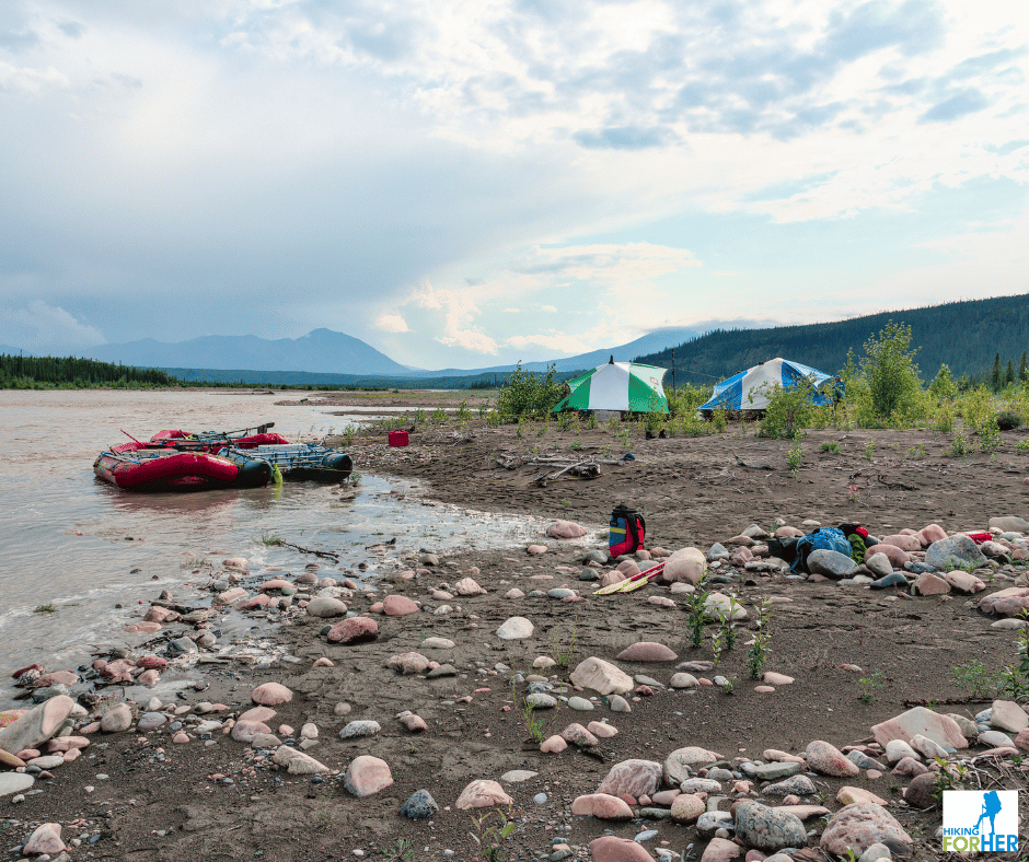
No roads, no trails, no established camps along the rivers we traveled.
Cue the bush plane
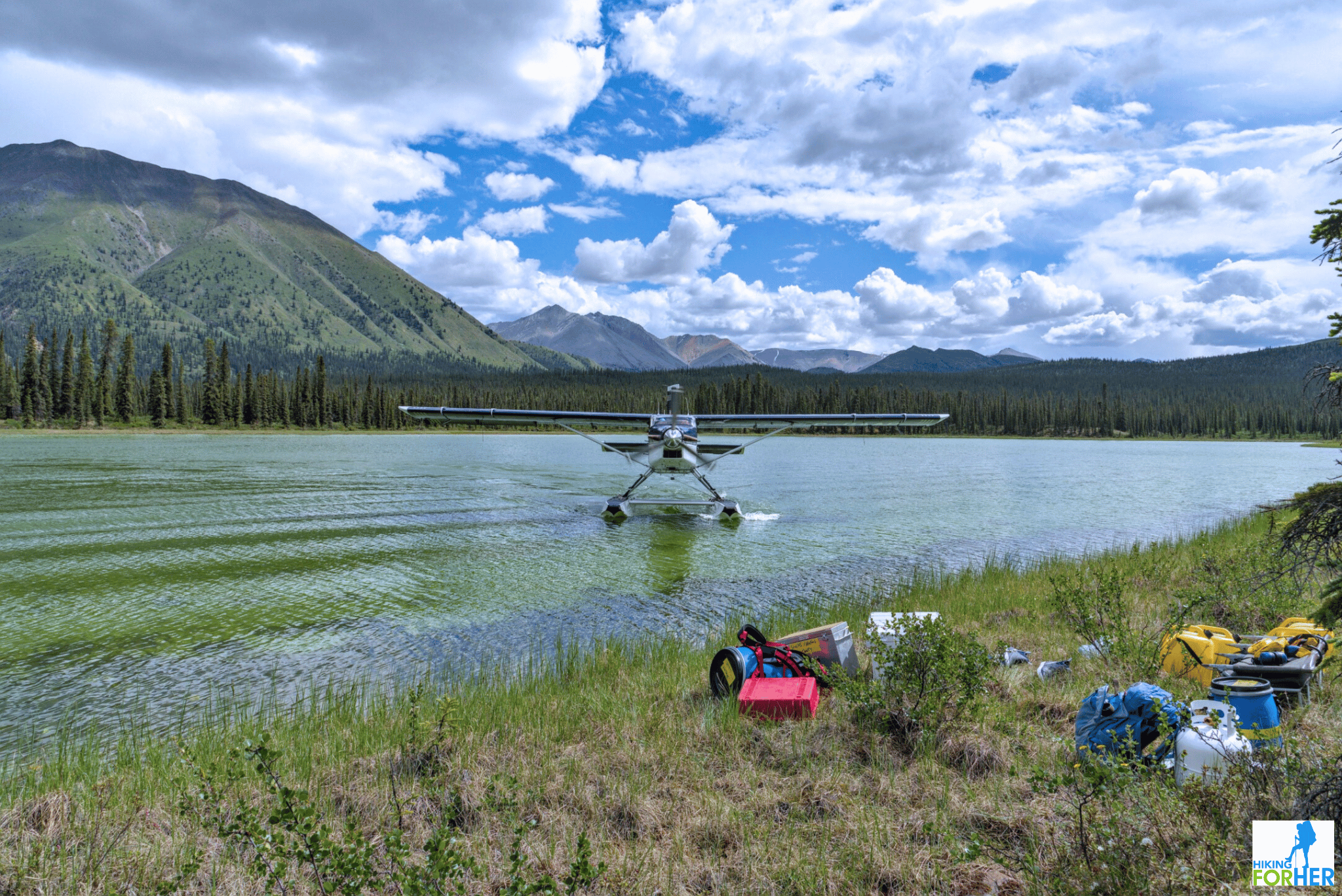
You need to arrive to the river put in location by a bush plane on floats.
The pilot needs to be very careful about the water levels of the lake, to avoid hazards like rocks or logs.
As a passenger, you're hoping for a landing near enough to shore to avoid a long wet slog with your gear.
In our case, we got two out of two.
Then what?
Once you're safely off the lake and standing on dry land with the gear, guess what?
It's time to enjoy a gear portage between the lake and the river.
- And by portage, I mean "make like an ant and pick up stuff larger than your own body, heave it over the hill and down to the river. Then do it again."
Nobody kicks back on a river trip, even if you're called a "guest".
So why do I want to go
to the Northwest Territories as a hiker?
I didn't make it sound very inviting, and that's on purpose.
You've got to WANT to be in this part of the world, because it's going to demand your time, attention, patience, endurance and fortitude.
And that's exactly why I go there: to have my outdoor skills tested, refined, and sometimes blown out of the water.
Not to mention the enjoyment of absolutely pristine conditions:
- Lake water so clear you can see caddis fly larvae crawling over rocks
- Game trails beaten across mountain faces that you can follow until you're tired
- Unimpeded sky above your head for weeks at a time
- Encounters with birds and mammals that leave you gobsmacked
Ready to get on the bush plane with me and visit this place?
Let's go!
Northwest Territories backcountry trip report:
quick overview of the 14 days
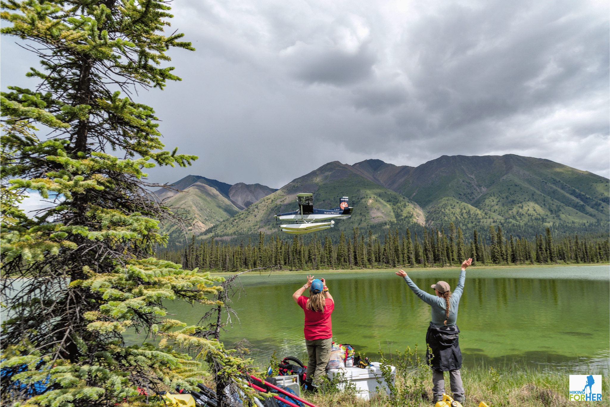 Good bye, thanks for the ride!
We began the trip by landing on shallow Thundercloud Lake deep in the Mackenzie Mountains, then putting in rafts on Thundercloud Creek.
During the trip we enjoyed 3 confluences (merging of surface waters): Thundercloud Creek (which was pretty big and fast for a creek, in my opinion) flowed into the Silverberry River, which joined Ravensthroat River, which dumped into Redstone River, and finally propelled us at great speed into the mighty Mackenzie River (a major transportation route in the North).
We covered 199 miles (320 km), enjoying high walled canyons, Class 2-3 rapids, and gorgeous mountain vistas along the way.
Northwest Territories backcountry trip report:
How the days unfolded
Mother Nature always has tricks up her sleeve, and that's why an easy start to sort out gear and personality types is the right way to begin a long trip.
The first two days were spent portaging gear over the ant trail, rigging rafts, learning how to set up an efficient kitchen system, and getting acquainted with river rafting safety procedures.
The third day, our first on the river, was a "troubleshoot and adapt" kind of day, becoming familiar with the rhythm of rafting and the expectations of the rafting guides.
The Thundercloud was a fairly burly creek as mentioned, and we got lucky with the water levels: no need to get out of the rafts to push, even fully loaded down with people and lots of heavy gear plus food.
- The fact that it rained the first 2 days had nothing to do with it ;)
By Day 4 we settled in to enjoy the 360 degree views of nameless mountain peaks, while riding the ever building current and splashy class 2-3 rapids.
After the first week on the river the Mackenzie mountains began to recede and instead we were surrounded by foothills. The night time temperatures were warmer; no morning frost on the tent walls!
It was fascinating to observe how plants, trees, birds and animals changed as the elevation dropped.
The river had grown hugely, the water turbulent and chocolate brown, and the current was very fast as we neared our final campsite. I didn't want the trip to end!
A few challenges
The first day of the trip was spent getting everyone to the river put in spot.
Severe thunderstorms and wind made that a little tricky, but the bush pilot was heroic (aren't they all?) and eventually all 7 guests and 3 guides arrived at base camp.
And by base camp, I mean a boggy, soggy narrow strip of land along one river bank about a third of a mile (500 m) from Thundercloud Lake.
By the way, isn't that lake well named? You can see thunderclouds building in the photos above.
As one of the first people in, I had the honor of numerous portages over fairly decent terrain as the weather drama played out.
- Trip after trip, gear strapped to my back, draped over both arms, wrapped around my waist, whatever it took to get tents, kitchen equipment, food, personal gear, rafts and other backcountry necessities where they could be deployed.
- To be fair, the guides and younger guests including my son took the heaviest loads, rigging up harnesses and hauling systems.
A hail and wind storm in the midst of portaging was an exciting first day event. The wind blew down some standing dead trees all around us, making it even more adventurous.
My tent (unoccupied) was a victim of a sharp pointed limb, but some Tenacious Tape fixed it right up.
First note to self as you read this Northwest Territories backcountry trip report:
Buy some Tenacious Tape.
First days on & off the river
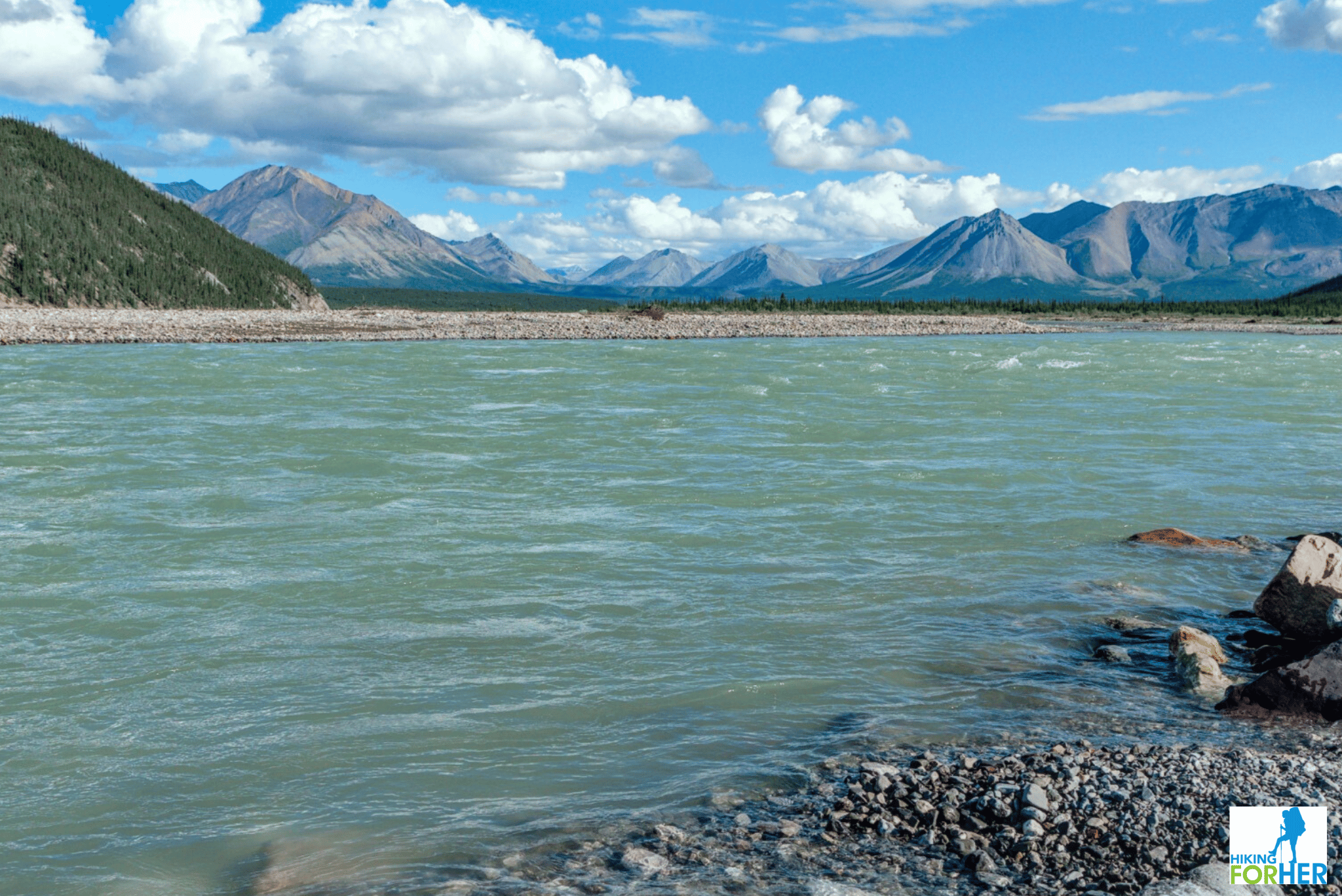 Unnamed peaks as far as the eye can see
This river system had never before been rafted, although one of the guides had canoed it several years previously and made some sketchy notes about possible campsites.
So navigation, camping spots, fresh stream water availability, and river running puzzles like canyons and white water were somewhat ... spontaneous, shall we say?
- That's what made this trip so special: being the first group to attempt and complete this long rafting trip.
The first few days of a trip are always a little rocky, until everyone figures out how to handle their individual shelter and sleep system and what the guides expect in terms of camp chores.
With such a large group of people (10 total), it was an agonizingly slow start before we actually got on the river each morning.
Our evening camping spots were either brushy and wet, or wide open and exposed. Both types of camping can be problematic, given weather and animal activity.
We managed just fine, and had no bear encounters. In fact, we had only one short glimpse of a black bear's backside the entire trip.
Second note to self
Always have bear spray handy on a backcountry trip, even with a large group of people.
Sometimes wind and weather dampens your scent and noise.
Surprising a mama grizzly is not anything you ever want to do.
Carry bear spray, each and every time you visit the groover (river lingo for port-a-potty) or fetch any gear from your raft or tent.
Getting into the flow, literally
Once we had our expectations and gear dialed in, the trip really started to flow on Day 4 and continued through Day 14.
Sunshine and fun river benchmarks made for high spirits.
But even the wet windy days had their beauty.
Noticing how the river responded to the terrain and to confluences was one of the best parts of this trip.
I'll give you a few other highlights so you can get a taste for this region.
Running the river canyons
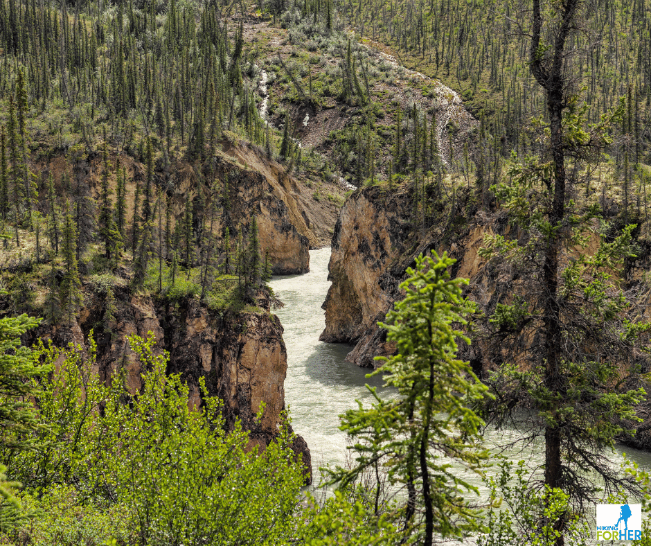 We used a game trail to climb above the canyon
Because this waterway had never been rafted from its beginning to end (only canoed a few times), it was important to scout upcoming rapids and canyons.
I liked this prudent approach for two reasons: safety (of course) but also a chance for me to scout for animal signs and tracks at river's edge while the guides did their thing.
- We saw so many moose, caribou and wolf tracks on this trip! It was exciting to imagine all the daily wildlife traffic along the river banks.
- Also of note were the amazing wild flowers, coral fossils and geological formations.
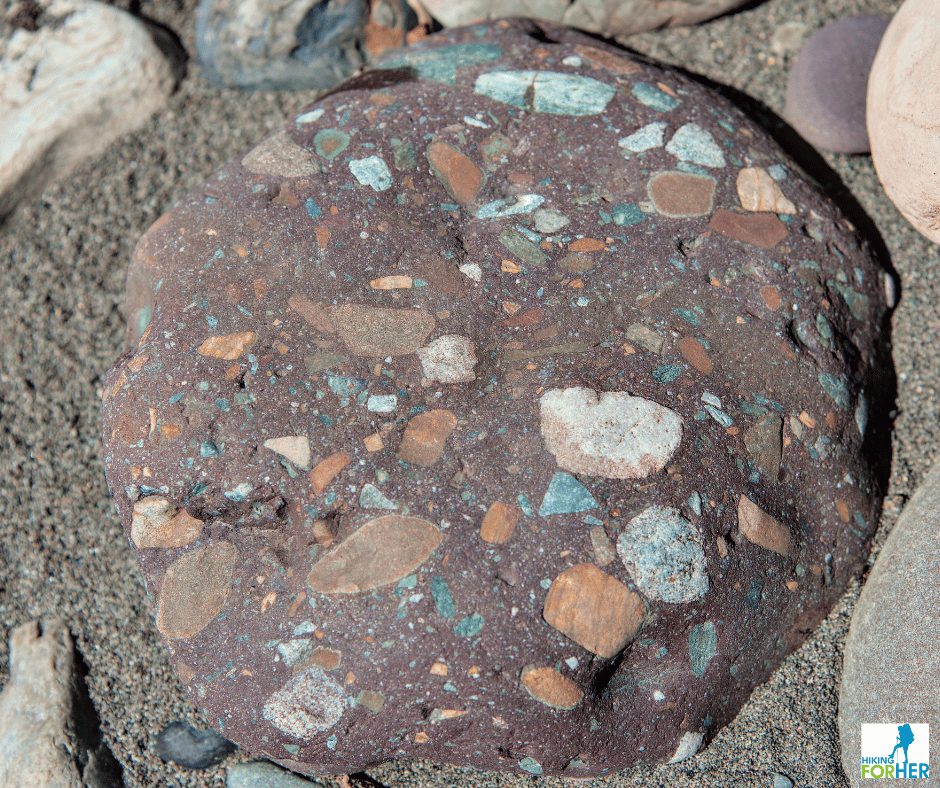 An example of the interesting geology, about the size of my head
Prepping for safe passage through canyons
Once the guides determined that the water level was appropriate and there were no hazards like undercut cliffs or snags to avoid, there were some preparations to be made before getting back into the rafts.
The rafting company mandated that Class 3 and above required dry suits for the guides. These are full body sealed jumpsuits with an uncomfortable collar around the neck, and hot as heck when the day warms up or you move around a lot.
They are incredibly expensive, too. Here's what one looks like so you can imagine the torture it is to get in and out of.
I've only had one on once during my Alsek River trip, and it was enough to cure me forever of wanting to wear another one.
We, the clients, donned helmets and splash jackets over our river hats and neoprene vests.
It's exciting to not know what's ahead!
And you have to trust the expertise of the guides. I find that it can be incredibly difficult to "let go" and let the river flow. But it's just one more way river rafting tests you.
Why no action photos from the Class 3 sections or canyons, you may wonder?
Nobody wants to risk expensive camera gear to the vagaries of a wild river.
You'll have to just imagine the impact of ice cold water on your face or down your neck, coming from all directions for minutes at a time. Fun stuff!
Amazing sights along the way I'd like to share
in this Northwest Territories backcountry trip report
You can also imagine what each new day brings on a river trip: the sky, the water, the weather, the rocks, the birds, the animal sightings all change hour by hour.
I'll share a few moments that really stood out for me as I write this Northwest Territories backcountry trip report.
Aufeis
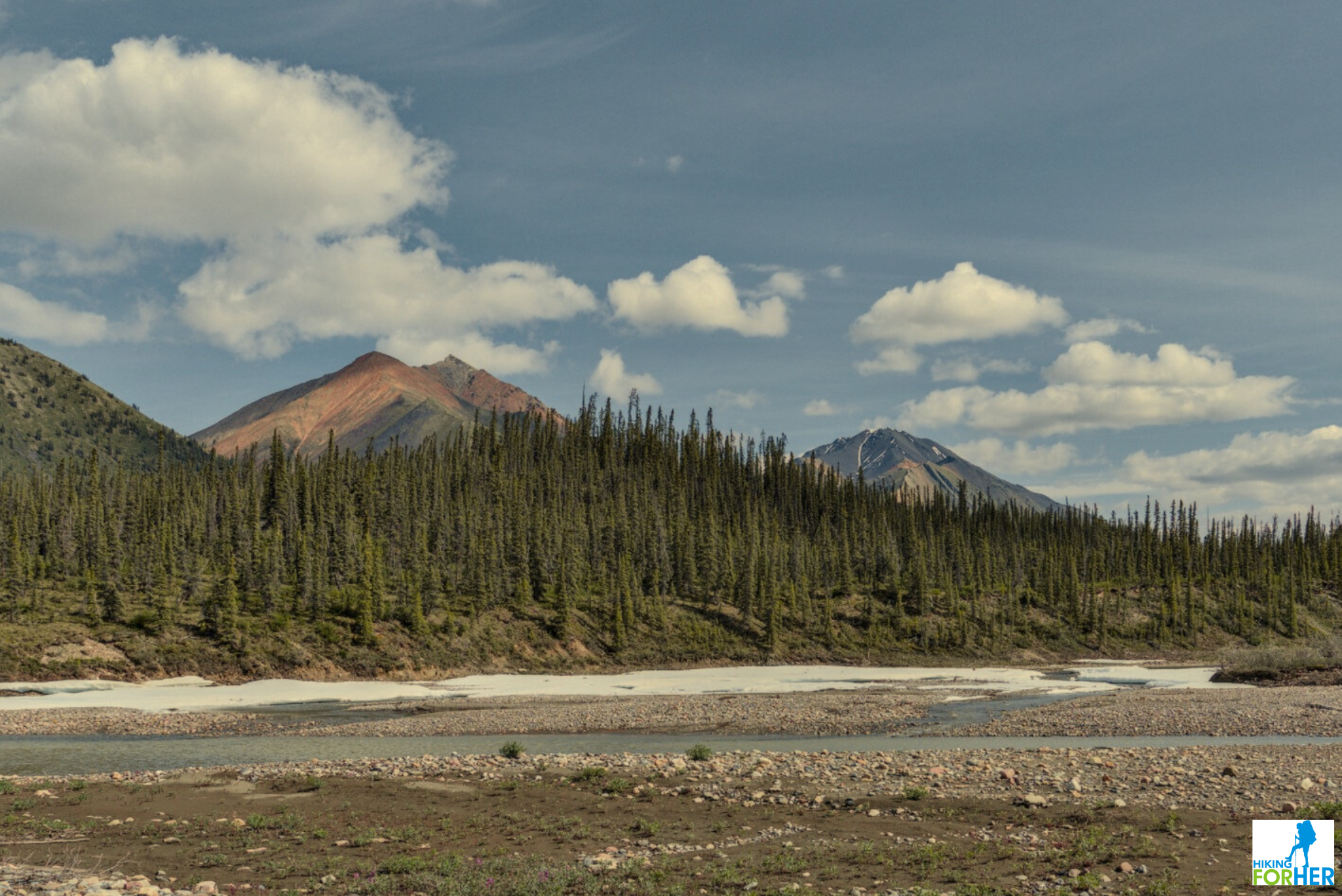
Ice in July!
Also called aufeis (pronounced "off ice"), a German word for "ice on top".
This ice forms only in arctic and subarctic regions during the winter along flowing water, and takes a long time to melt in the cool northern summers.
- Read the details on how and why it's formed here on Wikipedia.
For river rafters it's perfect for keeping food cold and to create an icy beverage for your evening fine dining experience.
Wildlife signs
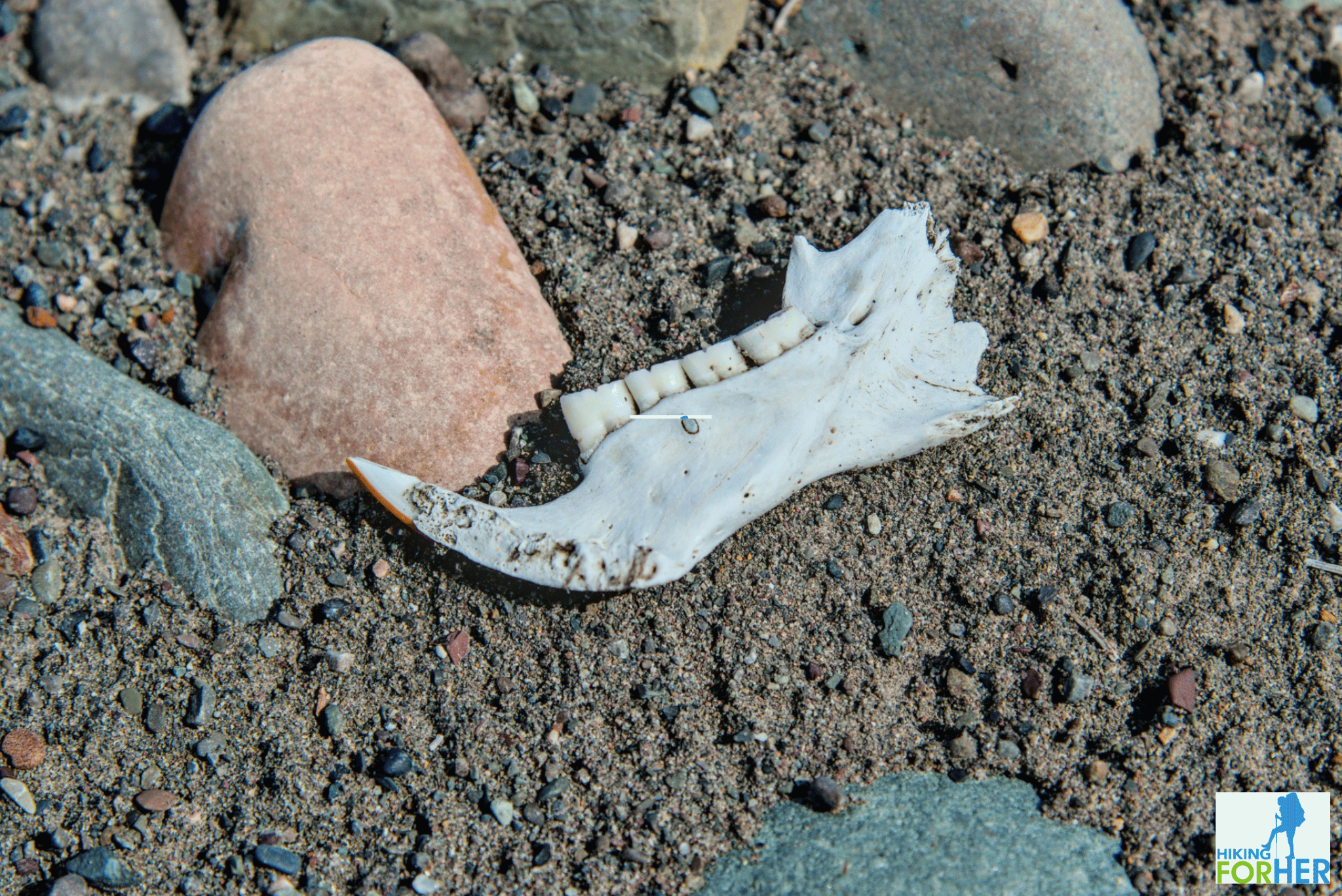 Caribou jawbone with gleaming white teeth
The wolves, without a doubt well known to the caribou, left tracks in the sand on the river banks for us to admire.
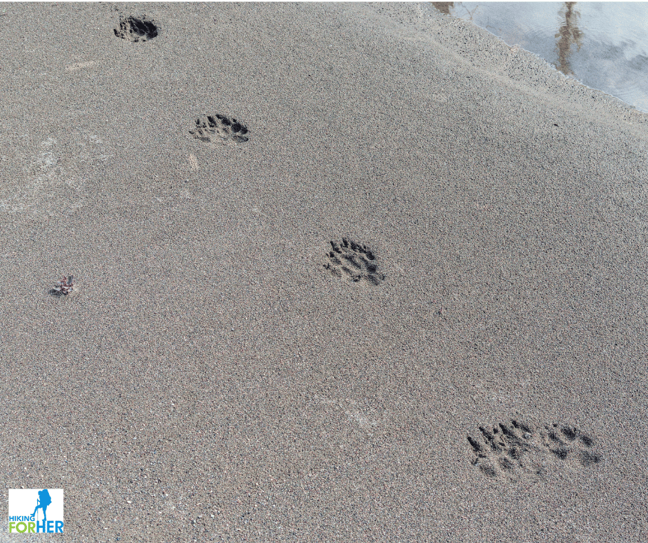 Each track was the size of my hand. Call me suitably impressed.
One of our campsites was dubbed "wolf camp" because of the huge number of dis-articulated bones and piles of wolf scat.
Not to mention the beaten in trail that had to be made by the wolves: tree limbs were just a hair above wolf height.
Camping in a large wolf dining room was something I had never done before. Don't worry, we left it in pristine condition so they could get back to business the next day.
I imagine they had to re-mark their territory with vigor to get rid of our scents.
Back home my curiosity about daily life as a wolf led me to this book about the wolf packs in Yellowstone National Park. I highly recommend it as the first book in a 5 book series written in meticulous detail by a leading wolf observer.
Waterfalls
Imagine floating around a corner and seeing this! We had to stop and take some pictures, right?
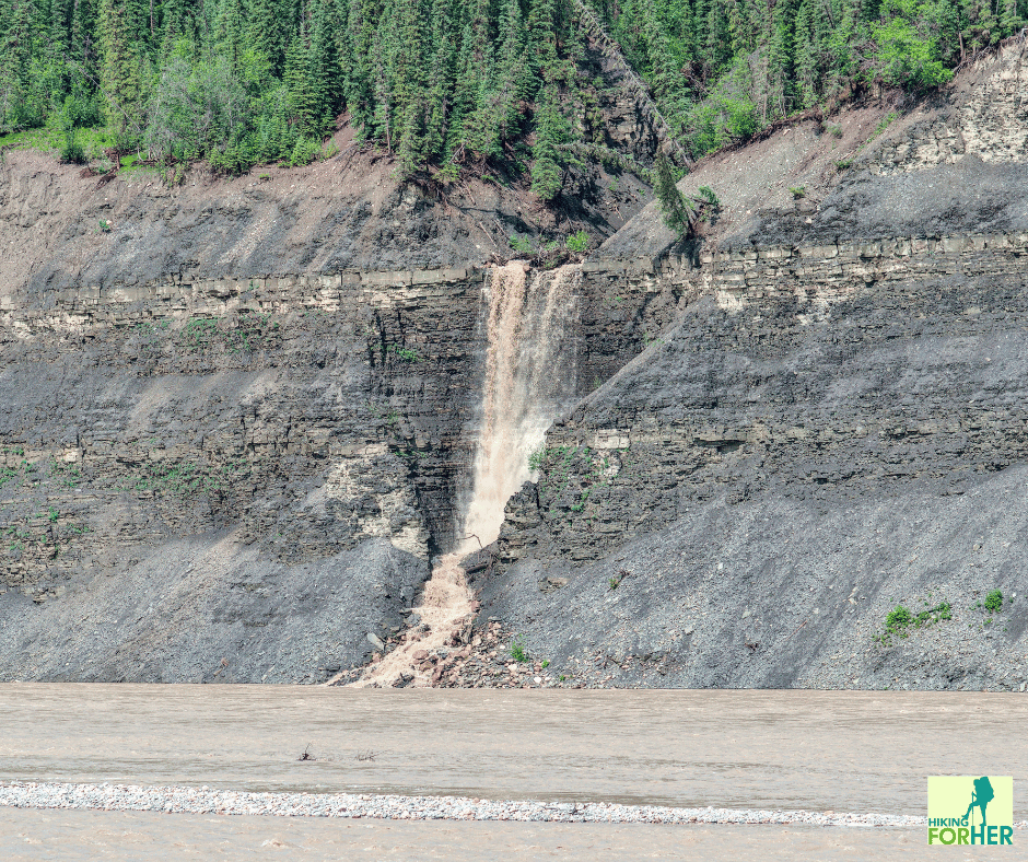
What a beautiful example of erosion at work, or what I like to call "Water, the Winner" along with her sidekick Gravity.
I wish I could give you the right sense of scale for this thundering water. Very impressive!
The neighbors
When we had rafted out of the mountains and into the foothills, we were hoping to see large game animals.
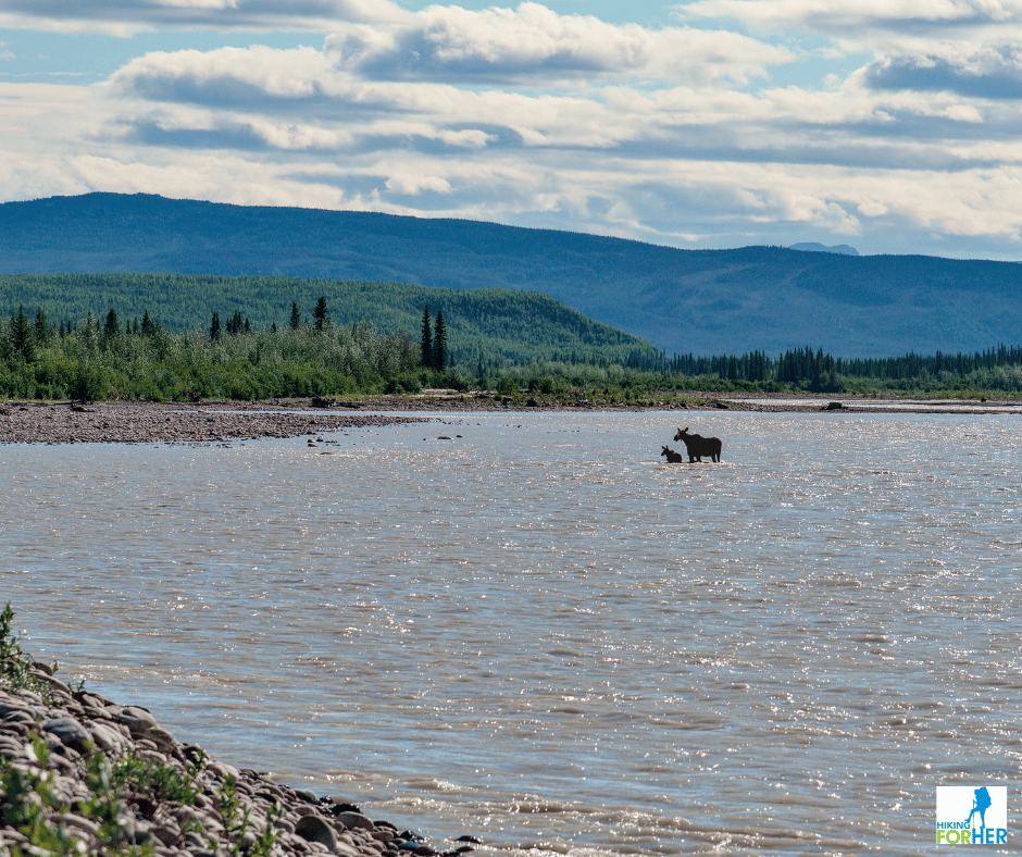
Mother Moose did not disappoint.
She was training her baby to cross the river but the current was too swift for the little one to manage in one go.
They paused several times to rest, making for a great opportunity for photos. It was heart warming to see how mom let the little one lean on her at times, giving encouraging gentle nose nudges.
Eventually the duo made it across the fast water and disappeared into the trees.
Dayhiking in this remote region
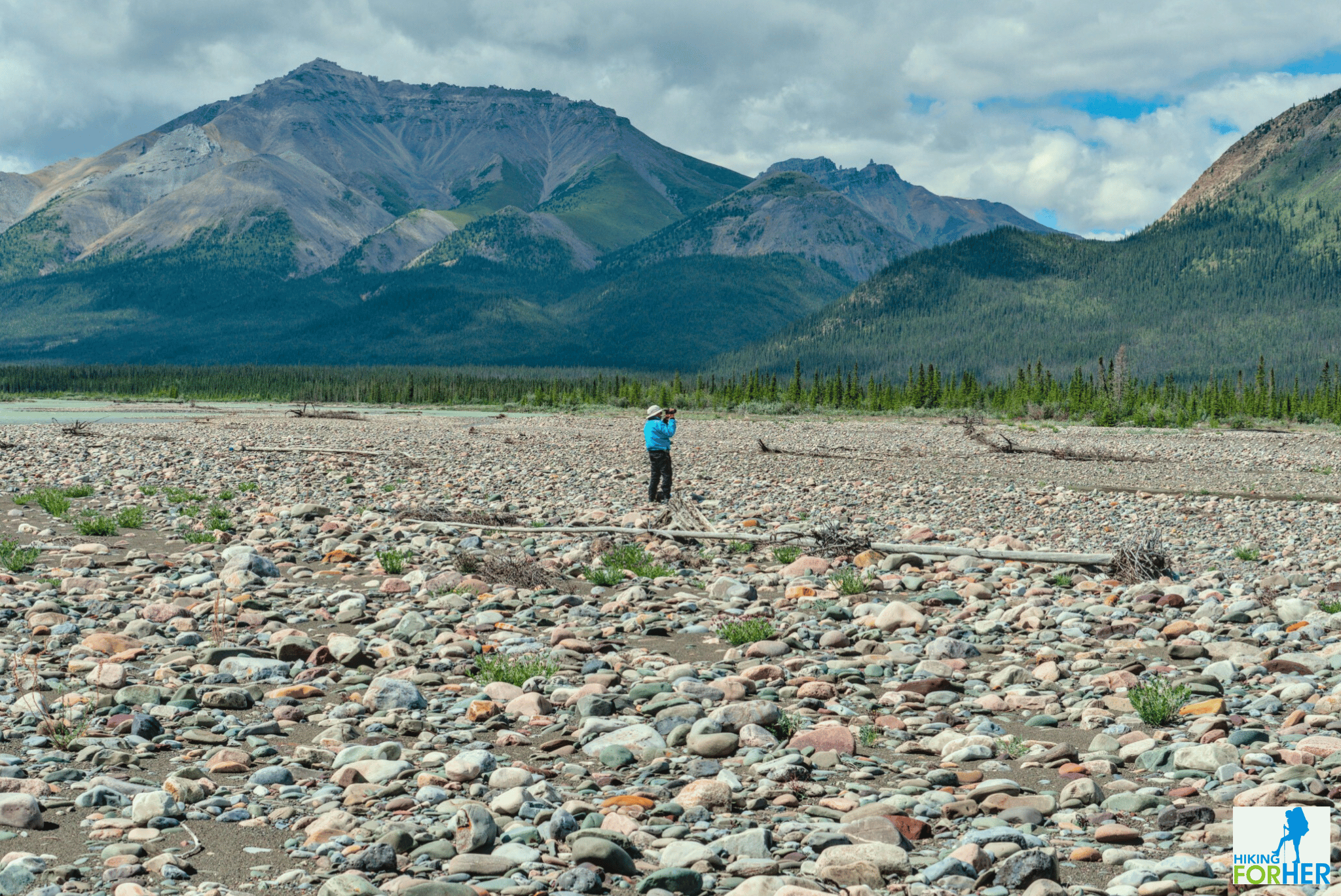
Because you're using the river as your transportation, you are going to have to get lucky in terms of suitable terrain for dayhiking in the NWT.
We poured over maps including Google Earth to figure out where our best options might be before we left for the trip, so we knew roughly what was ahead of us.
But sometimes river levels, washouts, blowdowns and landslides can fool you!
And the terrain can be incredibly fatiguing, given the rocky or brushy footing.
 Hiking up a canyon with the river valley below us
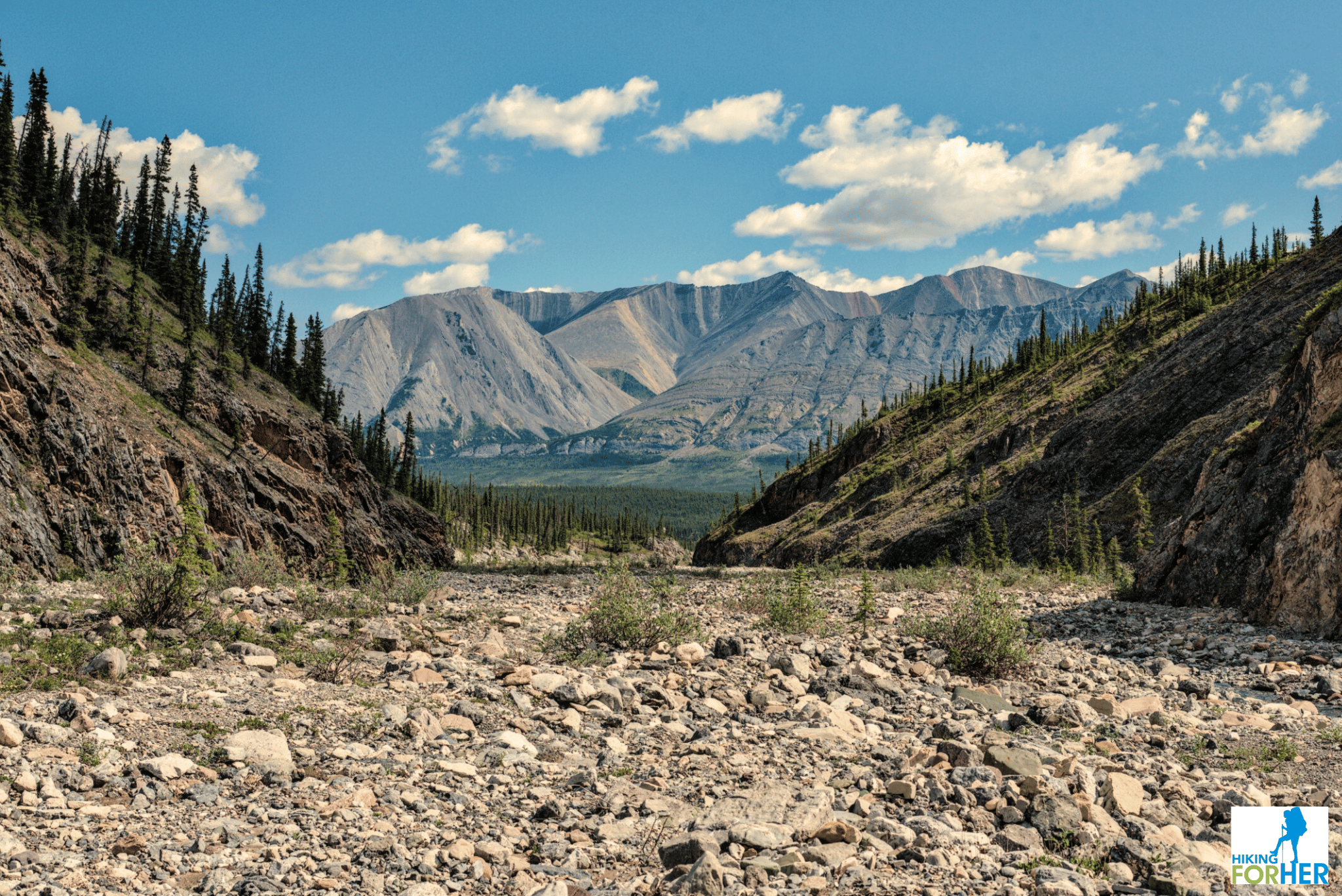
We only had one layover day on this trip due to a combination of things (so.much.rain), but we made the best of the endless daylight to explore a rocky canyon cut into the mountainside.
This stream bed was wide and easy to navigate at its terminus at the river, but became increasingly more challenging as we followed it up toward its narrow mountain origin.
As you can see, it was rocky footing and no shade cover.
What you don't see: Rock hopping across the stream, back and forth, too many times to count because of the meandering watercourse.
- Good balance is required, even when you legs grow tired. As I've mentioned, your hiking skills will be tested!
Other things to keep in mind if you dayhike these remote regions
- Don't daydream. Remember how to backtrack to base camp, or put in GPS coordinates as you move along.
- Pay attention to where you put each footfall. If you need to cross a stream multiple times, don't get cocky and jump or leap across.
- Be thoughtful and attentive to your surroundings and note distinct features you can navigate by if the weather turns evil (and it can do so in a few literal heartbeats).
- Stay alert for animal activity (bear signs like fresh digs or scat) especially when your sight lines are shortened or you're near loud water features.
- Slow down your pace. It's hard to hike in windy or sun scorched rocky conditions, at altitude, on poor footing, with no foreknowledge of your route. There's no sense in hurrying through this beauty, right?
- Turn around before you're exhausted. You've got a long way back to camp and the endless daylight can fool you into thinking it's still early afternoon.
- Be sure to pause often to take in your privileged surroundings. You may be the only human being to leave footprints here. That's truly amazing.
What gear do you need for a rafting and hiking trip?
That question assumes that rafts, guides, meals and camping gear are already lined up.
This Northwest Territories backcountry trip report picks up the plot at personal items needed for comfort and safety on a rafting and hiking trip.
It's a tricky combination, because you need 2 distinct sets of gear: river and land.
Weight is always the first consideration, along with volume.
Gear you already have that pulls double duty on a hiking and rafting trip
If you plan to hike on layover days (and you will of course hike!!), you need your hiking footwear and technical socks, trail clothing, and poles.
Note: On this trip I didn't bring poles because the terrain didn't seem to call for them. If I were spending more time hiking in the mountains I would have packed my poles.
As a hiker, you can use this gear for river time as well as hiking time:
- Water bottle
- Hat and neck gaiter
- Sunglasses
- Small carabiners to attach your day bag/pack to the raft
- Small personal first aid kit
- Personal care kit to prevent sunburn, windburn, dry eyes, chapped lips
Gear you need for river time
For rafting days in high altitude mountainous cold conditions, you need special river gear for warmth and dryness.
Here's what I wore:
- river pants with adjustable waist and ankles
- neoprene wetshoes
- waterproof socks
- river hat
- splash jacket for splashy sections (!!!)
- neoprene gloves
The company you're traveling with may provide additional items you'll need such as a life jacket, helmet, neoprene vest and neoprene shorts.
You only have so much space in your waterproof river bag for all that equipment plus your hiking gear.
- Mine was this 65L bag, plenty spacious for my clothing, hiking boots, sleeping bag, river and personal gear.
You'll also need a waterproof day bag to store your camera, water bottle, and sunscreen in the raft.
It can double as your hiking backpack if you choose carefully.
- Here's the waterproof 35L backpack I used, and I loved it. It had room enough for my video camera, extra jacket, water bottle, snacks, sunscreen and miscellaneous needs.
How to maximize your gear and reduce weight or bulk
Think carefully about making your trip gear pull double or triple duty.
Use a waterproof daypack like mine for both rafting days and hikes.You can also use it as a durable carry on bag for travel.
- While not the most comfortable backpack I've ever worn, it saved me from packing a bulky daypack that I would only use a handful of times.
- I'll share a thorough review with you soon.
Wear your neoprene socks for river days, but also as a comfortable waterproof insect barrier in your camp shoes. I used my crocs as camp shoes and also for wading in streams and pools.
- Some folks use sandals but as a hiker I'm all about protecting my feet. Crocs prevent stubbed toes and cuts.
Wear your river pants as rain pants.
Hiking in a splash jacket, not so great (too hot), so bring your rain jacket with hood.
If your ears get cold easily, a warm fleece headband can be used both on the river and while sleeping.
Camera gear needs to be protected against abrasion and moisture:
- On the river, clip an action camera to your flotation device.
- I wish I had packed my favorite small waterproof camera for the trip. I was mindful of bush plane weight restrictions and left it home.
- Off river, use a video camera like I do or whatever camera you would on a hike. Just be sure the lenses are protected at all times. Gritty, abrasive river water and sudden showers are not good for them.
Taking good care of yourself in the backcountry
 In my happy place, warm and dry
Because Hiking For Her aims to be an educational site for hikers, I'll throw in some additional hiking tips and tricks in this Northwest Territories backcountry trip report.
The first thing to think about when you're on a remote trip is safety.
Be sure the guides have a well stocked first aid kit and basic training.
Taking a wilderness first aid course yourself is a great idea.
Carry your own personal first aid kit to quickly treat scrapes and blisters, itchy insect bites and minor burns.
- It should contain twice as much prescription medication as you think you will need, if that applies to you.
Be sure the guide company has a satellite phone as well as an InReach or other communication device. Remote should not mean unreachable in today's technological civilization.
Bear spray, as outlined above, is your best friend in mountainous terrain. The hope is to never use it but always feel good about having it on your waist.
Even when carrying spray, don't venture too far from camp on your own unless you're in clear sight of camp. Always tell at least one person which direction you're headed, and then check in with them when you're back.
NOTE: You cannot use commercial airlines to transport bear spray. It is usually supplied by the company and must be secured outside the bush planes during flights.
Next, think of your personal comfort
There are many small inexpensive ways to keep yourself comfortable on a remote backcountry trip.
On this trip, we used hot water bottles to make our sleeping bags cozy while we were in the mountains. Such a luxury to savor all through the never-really-gets-dark arctic night!!
Bring tiny tubes of unscented hand lotion and lip balm, and be sure to reapply them all through the day. Your skin will get unbelievably dry and beaten up from all the times you set up and tear down camp, hold a paddle, wash dishes and help rig the raft.
If you just can't be satisfied without a particular type of tea or afternoon snack, bring it for yourself. Be sure it's stored in animal proof and water proof containers, not in your pockets or tent.
I'm sure you're expecting this: insect repellents, and plenty of 'em. Plus a bug net like this one to keep those huge horseflies off your ears. (It took me weeks to heal from bites around my ankles. No such thing as an ankle net. Maybe I just invented it?)
You could also wear a bug net shirt if you're one of the lucky ones that are bug magnets.
If you run cold, bring layers that trap body heat efficiently even if wet. Here's my layering system as a hiker. On the river, you can wear all or some of these clothes underneath your splash jacket and river pants.
Always have a pair of gloves handy while hiking or in camp, with waterproof covers when needed. These are in addition to the neoprene river gloves noted above.
Get your layering right on Day One and change it up frequently so you never get too cold. Temperature, moisture levels, amount of bugs lead to tricky calculations but if in doubt, put on another layer.
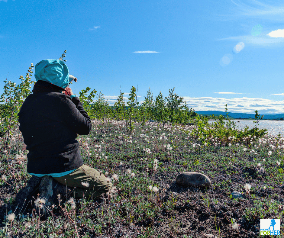 Here, I'm wearing my brimmed river hat plus a jacket hood, two layers of shirts and another jacket. The hat protects my eyes from glare, the hood keeps off bugs, and the outer fleece jacket blocks the wind.
This Northwest Territories backcountry trip report shares
more ways to stay comfortable and safe
Drink water even when you don't feel thirsty. Being outside day after day is dehydrating all by itself, but add in the amount of movement you're doing and you're going to need to drink more water than you expect.
Change into your hiking boots as soon as you get to your campsite.
- The neoprene wetshoes have flimsy soles and you want to protect your feet at all times.
- Crocs are clumsy when you're hauling gear from river to campsite.
Wear unscented sunscreen and sunglasses, all the time, even on cloudy days.
Lesson learned: One guy on the trip scoffed at sunscreen and then suffered very severe burns on his hands (high altitude plus dry skin, right?). He ended up having to wear... wait for it... oven gloves to protect his bandages.
While we're on this note, here's a shout out to all river guides everywhere. Along with bush pilots, they are my heroes.
When they make a suggestion for your comfort and safety ("Time to put on sunscreen"), it's based on long experience. They always have your well being in mind, because as one guide put it: "Without you, I wouldn't be out here enjoying the backcountry".
- If he says at breakfast there is a long stretch of river until lunch, eat hearty and slip an extra snack into your day bag.
- If she mentions some Class 3 river stretches coming up, be sure you've got your splash jacket and helmet on before getting into the raft.
Here's the way to look at it: If you become injured or debilitated it affects everyone on the trip, and may even cause the trip to be terminated. Listen to advice from the guides and be a team player!
Third note to self:
Hiking in the backcountry makes things extremely real. No one is going to rescue you in any hurry, you've got to make smart decisions and take care of yourself.
Be sure you have at least your 10 essentials handy, and know how to use them.
Please take my suggestions to heart.
Northwest Territories backcountry trip report all wrapped up
I could go on and on about this fantastic rafting and hiking trip, but I've decided to stop here.
If you were a real and not a virtual neighbor I'd invite you over for a personal slide show so you could see all the amazing sights and animals we encountered. The videos alone would keep us busy for hours.
- I'd skip the dreary rain delays and cold soggy nights, of course :)
If you ever have a chance to do a trip like this, please consider carefully if it's for you.
It's costly both in terms of time and money.
Be sure to carefully vet the guide company:
- Know what they provide and what you need to bring. Then bring it (talking to Oven Mitt guy here.)
- Read their philosophy and safety guidelines several times.
- Pay close attention to who they hire as guides.
Plan your gear list with utmost precision so you're covered for cold, heat, rain, snow, wind, bugs and unexpected gifts from Mother Nature. I hope my trip report and website will help you get started.
Be prepared to have your hiking, camping and survival skills pushed and tested in uncomfortable and sometimes extreme ways. You find out who you really are when push comes to shove.
If you're not into groups, the social expectations and trip norms may be hard to handle in a remote location begging for solitude and silence. Travel with the smallest group size possible to get the trip you desire.
You will return to civilization a different person. Know going into the trip that it will take awhile to re-acclimate. It takes me at least a month, no exaggeration, to somewhat fit into "civilized" life again after each remote trip.
You will earn a new appreciation for how humans deplete, destroy and desecrate the Earth when you travel through vast unspoiled areas. That may not be an entirely bad thing, if it leads to taking action.
And as a hiker, you will cherish this sacred glimpse into the daily lives of predators and prey. That's precious stuff right there!
Thanks for coming along for the ride (bush planes and rafts and hiking boots, oh my!) in this Northwest Territories backcountry trip report.
If you have specific questions for me after reading this Northwest Territories backcountry trip report, use my contact page. I answer every email.
Home page > Remote Hiking Destinations >
Northwest Territories Backcountry Trip Report
|
I get emails all the time about what I wear, eat, carry and love to use on the trail. That's
why I provide affiliate links to you: the best gear that I use myself and have seen used by other hikers is instantly
available for your consideration, and the gear company sends a few
pennies per dollar to this reader-supported hiking website. There is no added cost to you! Everyone ends up a winner: Great gear for you, strong gear companies, and more free hiking tips for everyone. Thanks very much for your support. It's warmly and sincerely appreciated. It also helps send these hiking tips to all your virtual trail buddies around the globe. |
 |
